


Hiking
Signposting of trails
These are some of the signs you will find when you take the routes we describe below.
(PR) SSMALL TOUR TRAIL:


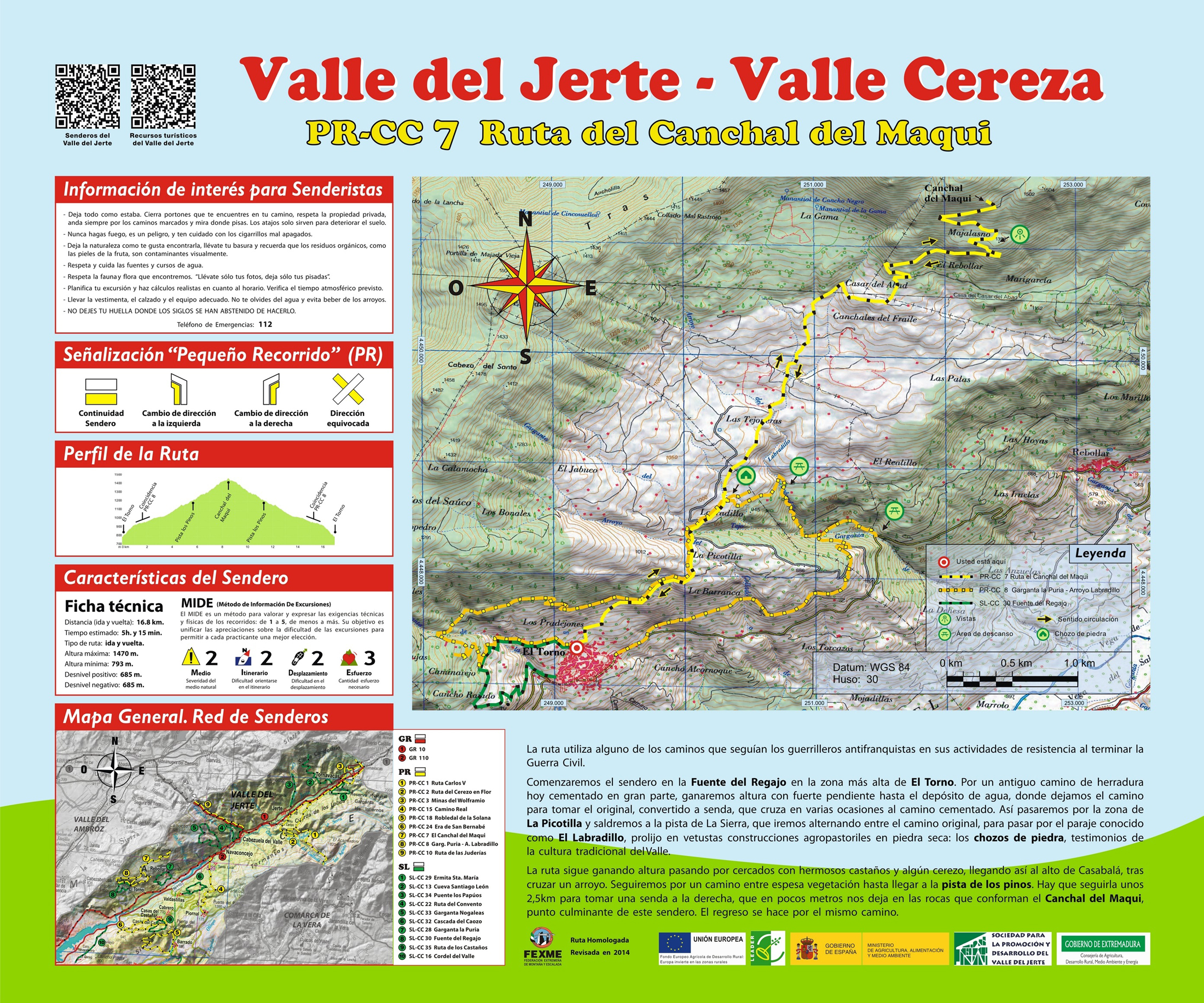
Route PR-CC 07 - Canchal del Maqui
The trail uses one of the roads used by anti-Francoist guerrillas for their resistance activities during the Civil War. It ends in a rocky zone that served as a tempo- rary shelter for the leading players of that struggle. The trail moves between uncultivated zones and meadows and crop enclosures, showing nume- rous examples of the valley’s vernacular architecture.
We leave from Fuente del Regajo in El Torno. We ascend via the old bridle path, alternating between concrete sections and the original stone path, until we get to the spot known as El Labradillo, which is full of old agropastoral dry stone constructions—stone huts that are testimonies of the valley’s traditional culture. The route continues uphill passing through enclosures with chestnut trees and a cherry tree here and there and arriving at a high point after crossing a creek. We continue along a road amid thick vegetation until we get to the Los Pinos track that we follow for around 1.6 miles until we take a trail on the left which, within a few feet leaves us on the rocks that make up El Canchal del Maquí, the end point of this trail. The return is via the same road.


Profiles

Technical sheet
Route: Linear return
Start: El Torno (Fuente del Regajo)
Finish: El Torno (Fuente del Regajo)
Length: 10.4 miles
Estimated time: 5h 15min
Difficulty: Medium-hight
Height difference : 2,247 ft
Height difference : 2,247 ft
HIM