


Hiking
Signposting of trails
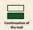
These are some of the signs you will find when you take the routes we describe below.
(SL) LOCAL PATH:


Route SL-CC 30 Fuente Regajo
The El Torno sierra is rich in examples of vernacular constructions, including stone huts, shelters, pens, enclosures, etc., all of which have the common characteristic of being built using the “dry stone” technique. This old way of life catches our attention as an antidote to the march of new production techniques.
The trail starts from the high part of the locality, in the zone known as Fuente Regajo and sharing the starting point with the PR-CC 7 (Canchal de Maqui). Following the narrow trail between stone walls, we pass La Hoya de las Canales creek and, ascending amid oak trees, come to a wide road that gently descends, approaching the visible telephone antennae that dominate El Torno. After passing over them, we take a descending trail on the left in search of the aforementioned creek. We reach it and cross it next to a natural pool and the ruins of a windmill. Continuing along the road, we come to the first houses of El Torno, pass through the square, past the church, and approach the starting point.


Profiles

Technical sheet
Route: Circular
Start: El Torno
Finish: El Torno
Length: 2 miles
Estimated time: 1h
Difficulty: Low
Height difference : 449 ft
Height difference : 449 ft
HIM
