


Hiking
Signposting of trails
These are some of the signs you will find when you take the routes we describe below.
(SL) LOCAL PATH:


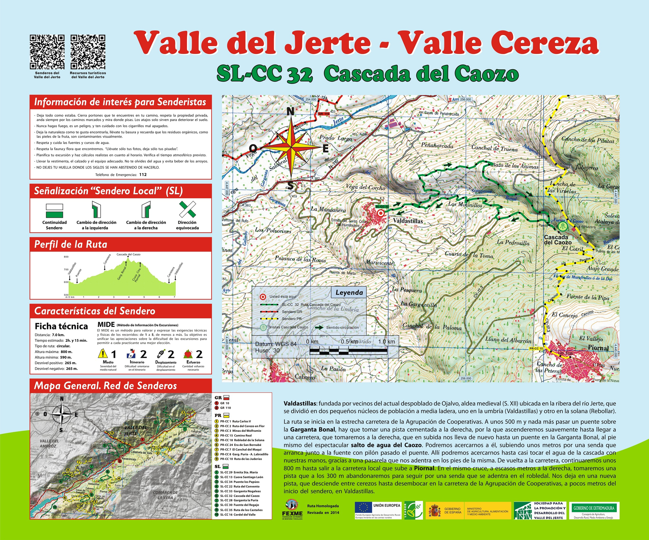
Route SL-CC 32 Caozo Waterfall
Valdastillas, whose name means valley of kindling or firewood, would be the place where Ojalva inhabitants would come to collect firewood for their homes. It was founded by inhabitants of the now abandoned town of Ojalva, a Medieval village located next to the river Jerte that was divided into two small population centres half way up the hillside, one on the north-fa- cing slope (Valdastillas) and the other on the south-facing slope (Rebollar).
We start the trail on the narrow motorway from the Cooperative Association. Some 1,640 ft after passing this route’s return road and a bridge over Bonal ravine, we take a concrete road on the right, starting an ascent amid olive and cherry tree orchards as far as the IRYDA motorway that we follow to the right as far as Bonal ravine, at the very foot of the spectacular Caozo waterfall. On the way back to the motorway, we continue some 2,623 ft as far as the crossroads with the local motorway that ascends to Piornal. There, we immediately turn onto the first road on the right that ends up becoming a narrow trail that enters the oak wood to take us to the vicinity of Valdastillas and its natural pool, very near the starting point.


Profiles

Technical sheet
Route: Circular
Start: Valdastillas
Finish: Valdastillas
Length: 4.3 miles
Estimated time: 2h 15min
Difficulty: Low
Height difference : 869 ft
Height difference : 869 ft
HIM
